
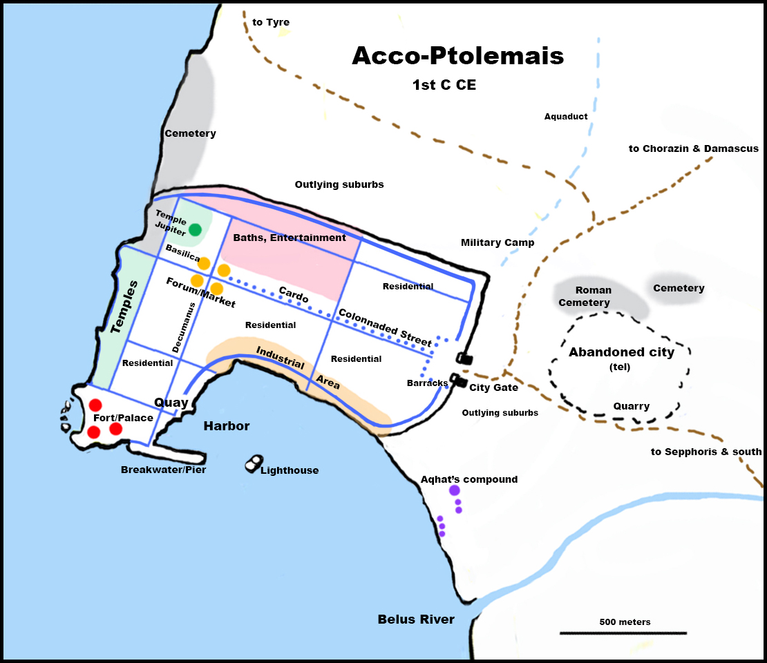
This is a very general map, since most of the ruins of Acco’s New Testament period were either destroyed or buried under the present city. The city gate, the old city on the tel, the cemeteries, the industrial area, the military camp, and the quay and harbor are definite, although archaeologists disagree about whether the lighthouse was really a lighthouse.
The streets are guesswork, based on other Roman cities in the area, as are the market and city center. The are some indications that the baths and entertainment areas (pink) were located where they are marked. A few temple ruins have been discovered at Acco–specifically near the north city wall, outside the city gate, and on the tel–but they predate the Roman period. I chose to locate the major temple complex along the sea wall because of a similar placement in the city of Dor. The fort and palace are also a guess, although there are signs that monumental structures of some sort did stand there.
The Belus River has changed its course dramatically over time. Its placement on the map is approximate.
Aqhat’s compound is placed a distance away from the city because of the offensive odors involved in processing the purple dye.
![]()
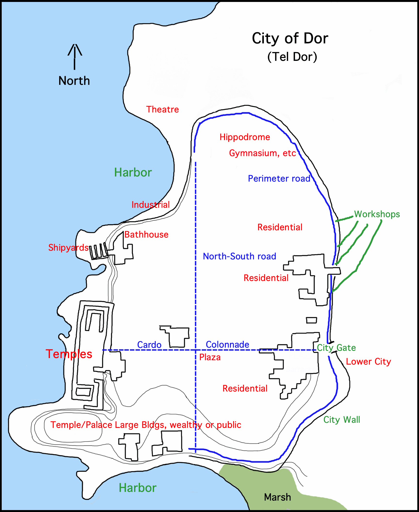
Tel Dor, site of the ancient Phoenician city of Dor, is one of the richest excavation sites in Israel. Largely undisturbed by rebuilding, the ruins of the ancient city remain relatively intact, except for erosion along the coastline, farming, and reuse of quarried stone. Barely 35 miles south of Acco, its history and architecture are quite similar to Acco’s. Many of the details of Acco in Cat Born from the Purple were taken from the excavations at Dor.
![]()
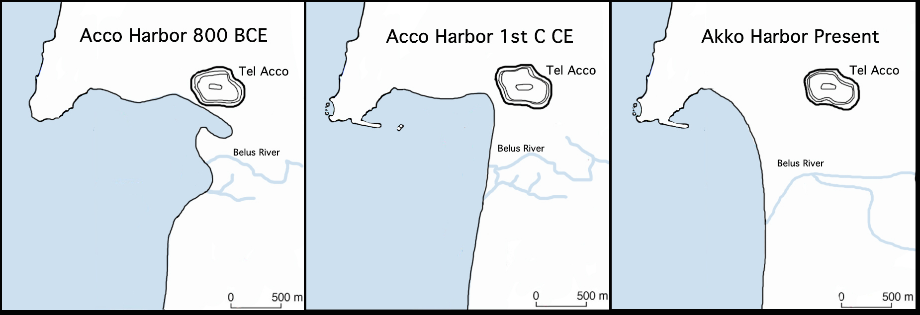
In the midst of doing research into the history of Acco-Ptolemais, I discovered that the city’s move from the tel to the present location was due to the gradual disappearance of Acco’s original harbor. Starting at approximately 4000 BCE, the Mediterranean shoreline at Acco started slowing advancing into the sea. By around 1000 BCE the rate of advance increased, until, in the late Persian period (400-300 BCE) the original harbor at Acco, located at the base of the tel, had become marshy ground. The nearest deep water anchorage had moved out into the Mediterranean, approximately to where it is today. Most of the commercial and residential areas of Akko were relocated to the actual coastline at that time, leaving only civil and religious buildings functioning on the tel. In time the tel was abandoned entirely, partly because it was now outside the city walls and vulnerable to the frequent attacks on the city. The three maps above show the changing coastline over time.
![]()
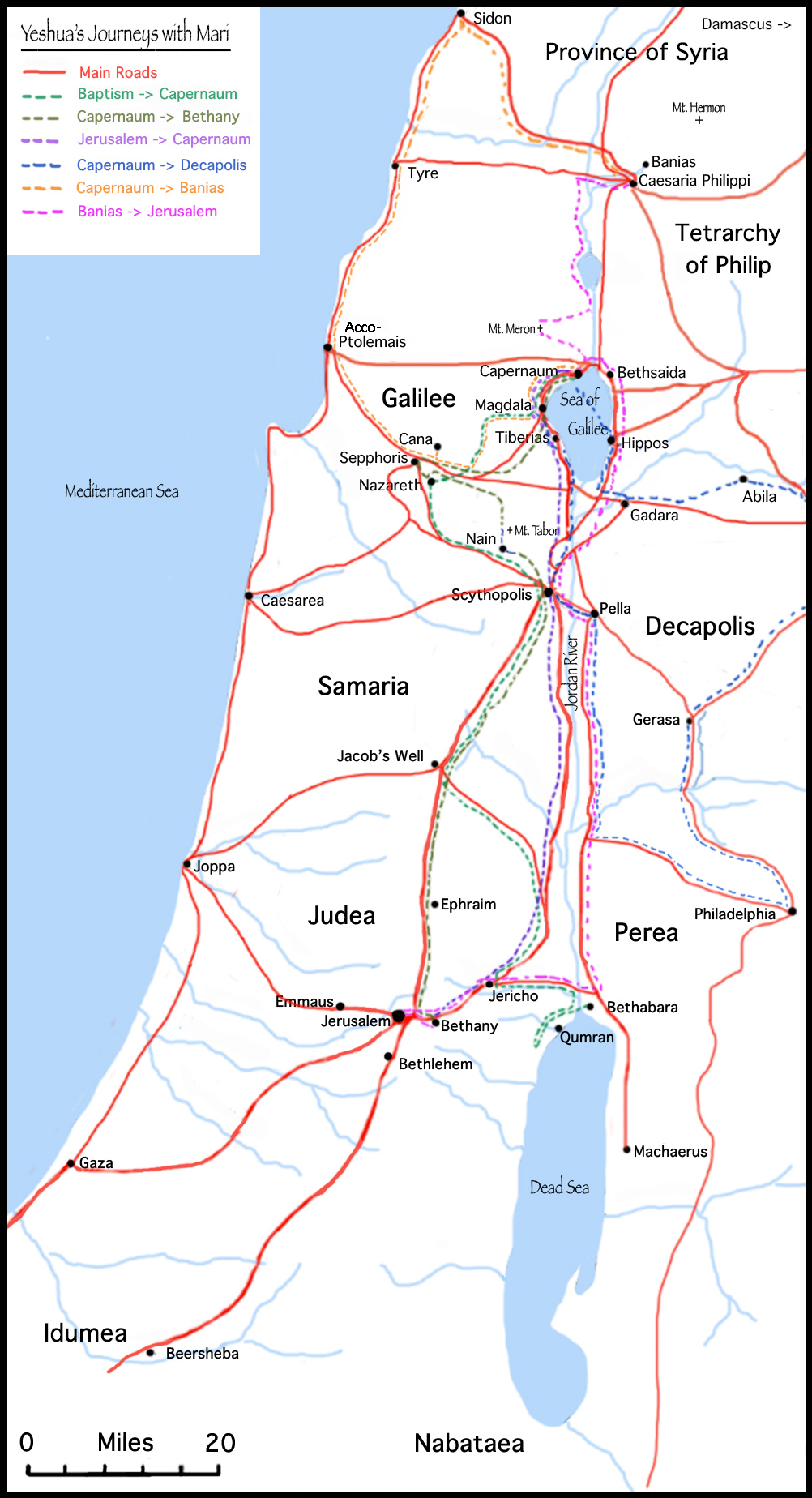
Map of Yeshua’s journeys from The Gospel According to Yeshua’s Cat . . . and a context for the journeys in Purple.