
Map of the journeys in TCOR
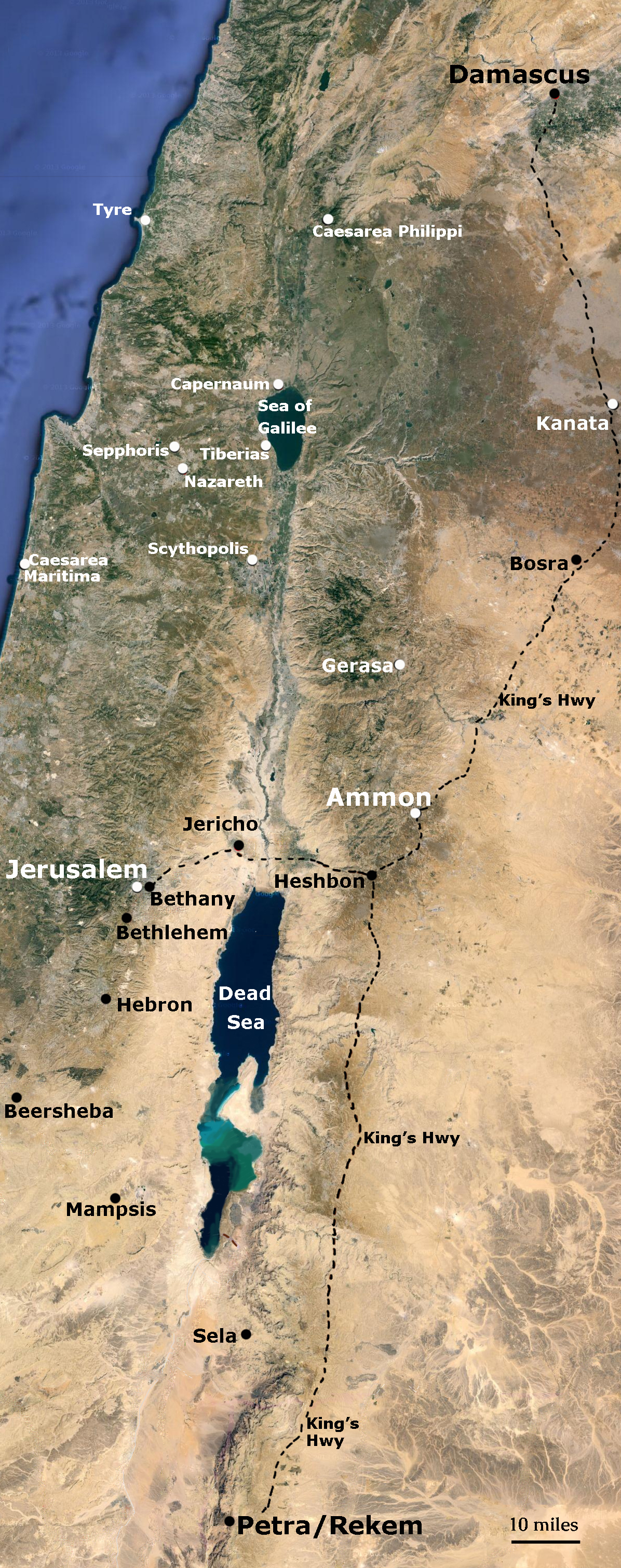
The map above shows Rekem (contemporary Petra, Jordan) at the far southern end of the map. The dotted lines show the trips described in the book: Rekem to Ammon (map center); Rekem to Bethany (by Jerusalem): and Rekem to Damascus (far north of map).
![]()
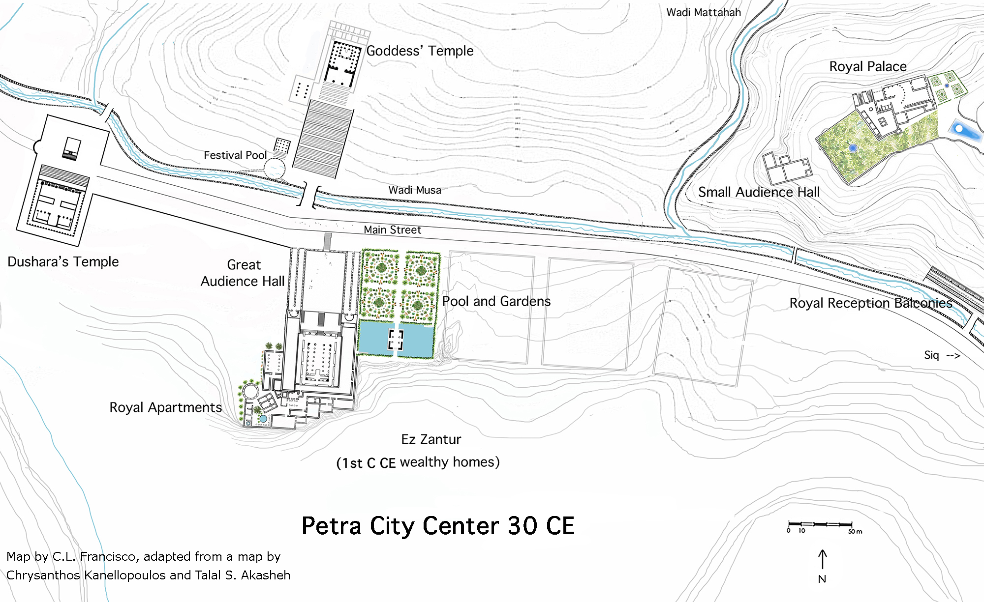
Map of Rekem in 30 CE
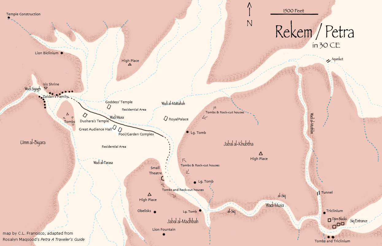
This map shows the location of main buildings in the central valley and wadis in Rekem/Petra as they probably existed in 30 CE. The names of the various buildings are those used in the book, not contemporary names.
![]()
Artist’s reconstruction of Rekem city center (adapted)
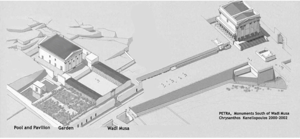
Reconstruction of the “Great Temple” (probably the king’s audience hall) with adjoining garden and pool complex, the main city street following the Wadi Musa, and the temple of Dushara (Qasr al-Bint). with its large courtyard and altar. (Original reconstruction by Chrysanthos Kanellopoulos, veteran archaeological artist at numerous Petra sites)
![]()
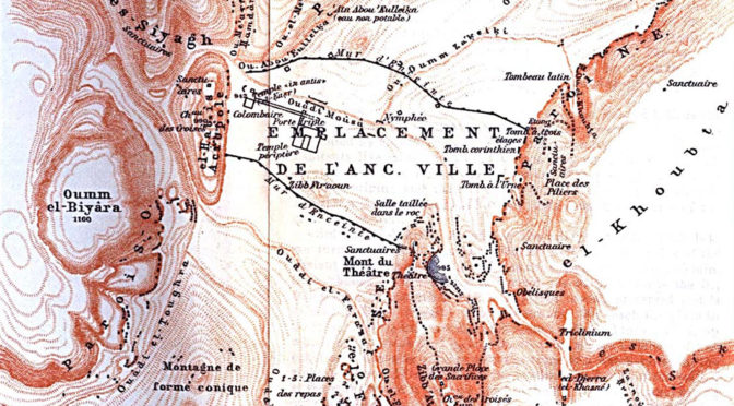
Author’s plan of Rekem city center
Dushara’s Temple, the core of the Goddess’ Temple (Temple of the Winged Lions), and the central building of the audience hall, pool, and gardens are based on current excavations, although the drawings are the author’s. The royal apartments attached to the audience hall and the Goddess Temple’s outbuildings are the author’s additions. The royal palace and small audience hall are almost all the author’s imagination, based on the early stages of recent discoveries on site by the NEPP archaeologists (see Buildings page).
![]()
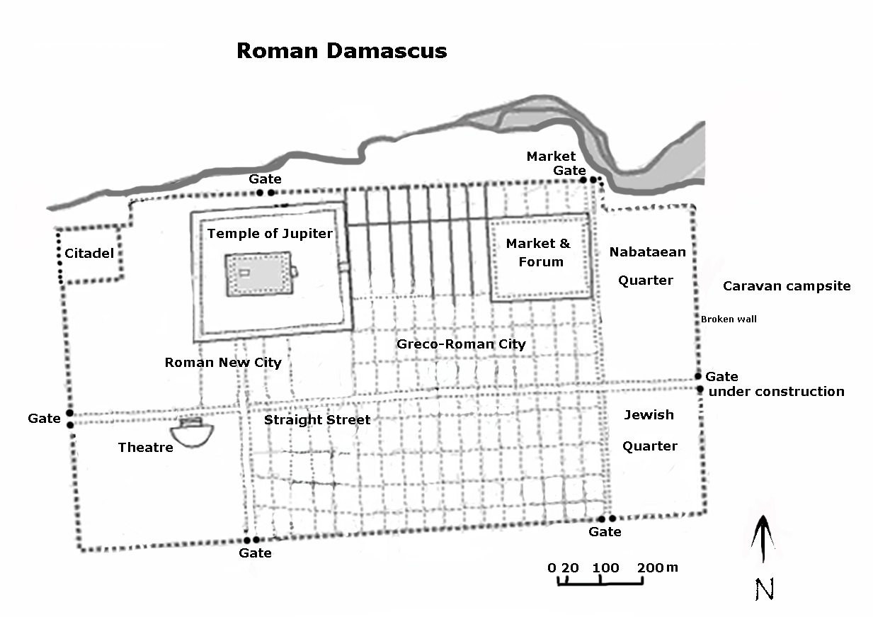
Map of Roman Damascus
.

.
